Circular foundations excavated on Rosemary Island date to the end of the last ice age – a time of ‘environmental stress’ for the Indigenous inhabitants
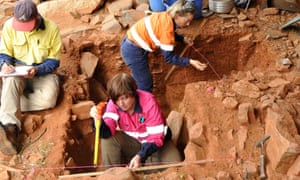
Archeologists working on the Dampier archipelago off Australia’s north-west coast have found evidence of stone houses dating back 9,000 years – to the end of the last ice age – building the case for the area to get a world heritage listing.
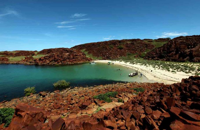
Circular stone foundations were discovered in on Rosemary Island, the outermost of 42 islands that make up the archipelago. The islands and the nearby Burrup peninsula are known as Murujuga – a word meaning “hip bones sticking out” – in the language of the Ngarluma people.
Prof Jo Mcdonald, director of the centre for rock art research and management at the University of Western Australia, said the excavations showed occupation was maintained throughout the ice age and the period of rapid rise in sea levels that followed.
“Around 8,000 years ago, it would have been on the coast,” McDonald told Guardian Australia. “This is the time that the islands were starting to be cut off and it’s a time when people were starting to rearrange themselves.”The sea level on Australia’s north-west coast rose 130 metres after the end of the ice age, at a rate of about a metre every five to 10 years. “In people’s lifetimes they would have seen loss of territory and would have had to renegotiate – a bit like Miami these days,” McDonald said.
The placement of the stone structures indicated how that sudden space restriction was managed, she said. “The development of housing is really significant in terms of understanding how people actually divided up their space and lived in close proximity to each other in times of environmental stress.”
Research done in the past 12 months had found evidence of human occupation in Murujuga dating back 21,000 years, or before the last ice age, said McDonald.
Earlier research on Barrow Island, about 100km west, found evidence of human occupation dating back 50,000 years.
McDonald said the latest discovery helped build the case for the area to gain a world heritage listing.
The Western Australian government is facing increased pressure to support a world heritage application for the area, which has been on the national heritage register since 2007.
It was assessed as meeting Unesco’s six world heritage criteria in 2011 but a formal nomination cannot be made without the support of the state government. The premier, Colin Barnett, said last month that the area would “probably be a world heritage site at some stage”.
“Our responsibility now is to protect these rock carvings and also make it possible for people to come and see this extraordinary place,” he said.
There are 2,500 registered Aboriginal heritage sites on the Burrup peninsula and surrounding islands, which are located near Karratha, 1,525km north of Perth.
The area is also home to the US$2bn North West Shelf gas project, the largest oil and gas development in Australia.
The entry to the largest heritage site, a valley containing close to a million rock carvings dating back 40,000 years, is within a kilometre of a fertiliser plant. Last year the WA government removed a large umbrella heritage listing for the peninsula because it complicated development applications.
The research done by McDonald and her team was co-funded by Rio Tinto, which has a mining lease within the national heritage area, and Murujuga Aboriginal Corporation.
McDonald said the state heritage management had been “really hotchpotch” but that existing industry could be co-managed with a world heritage site, providing suitable buffers were put in place.
Source: The Guardian













Leave a Comment
You must be logged in to post a comment.