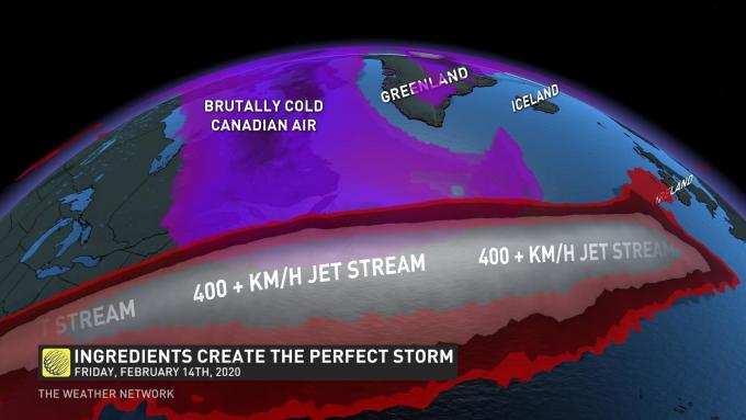
To pull off this atmospheric feat to create this perfect storm, the upper-level support with the jet stream is off-the-charts ideal
Source: The Weather network
Everything is in motion to drive an area of low pressure to the absolute limits this planet can muster.
The North Atlantic is infamous for generating some of the most ferocious storm systems on Earth. This weekend, the atmosphere will put on an incredible spectacle.
The systems crossing Atlantic Canada are the catalysts for explosive cyclogenesis, the rapid deepening of an area of low pressure; once these storms move east of the Avalon Peninsula, they encounter extremely favourable conditions to rapidly intensify.
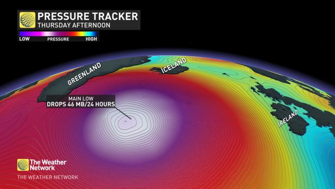
THURSDAY
The recent snow events across Atlantic Canada, somewhat anemic by the standards of the region, set this in motion, with one of these lows set to drop 46 millibars in under 24 hours by Thursday evening.
This is only the beginning.
FRIDAY
By Friday, the dominant low splits into two lows, with the main low weakening, and a serious drop in pressure are expected near the southern tip of Greenland.
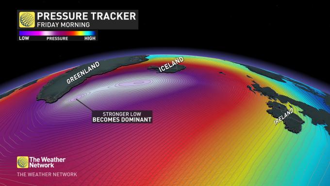
An upper trough is swirling over the North Atlantic, and at one point, three incredibly deep regions of low pressure will pinwheel around the upper trough through the weekend.
FRIDAY EVENING-SATURDAY
The grande finale, the extreme jet stream extending across the Atlantic, allows this low to deepen at an unfathomable rate. Pressure drops of more than 50 millibars in 24 hours are quite rare for extratropical cyclones.
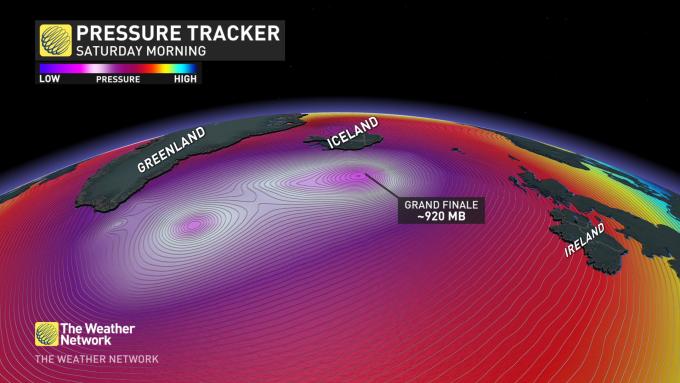
RECORD WORTHY
Checking the climate reanalysis, anything approaching 920 millibars is the deepest lows encountered on this part of the planet.
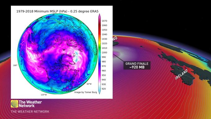
THE SCIENCE BEHIND
To pull off this atmospheric feat to create this perfect storm, the upper-level support with the jet stream is off-the-charts ideal. The jet stream is forecast to peak over 400 kilometres an hour; simultaneously, bitterly cold Canadian Arctic air migrates over the North Atlantic. A jet stream of similar intensity recently set a transatlantic flight record.
MEGA WAVES
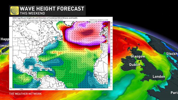
All eyes are on Ireland, as ginormous swells are poised to target the region, right on the heels of storm Ciara. Low-pressure systems of this magnitude are known to generate rogue waves near 30 metres tall, with significant wave heights over 15 metres possible over some areas of the Atlantic throughout this weekend.
Source: The Weather network









Leave a Comment
You must be logged in to post a comment.