In a new video, NASA announces a small satellite’s big milestone: It has produced the first map of ice clouds across the world.
Clouds are filled with billions of water droplets and ice crystals. In fact, that’s why clouds are cotton-ball-colored: Sunlight reflects off all these small particles, producing a white color. And beyond giving clouds their iconic appearance, these droplets and crystals also impact the type of precipitation clouds give off, NASA officials said in the video. Ice particles, for example, can create downpours.
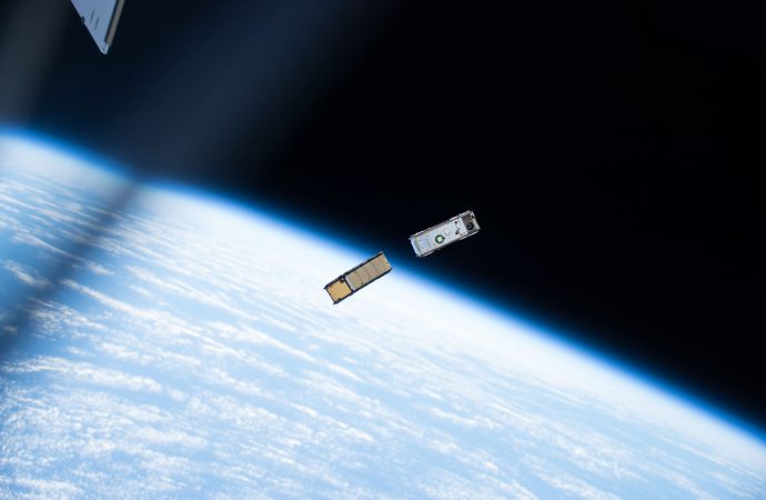
Enter IceCube, a tiny, 10-lb. (4.5 kilograms) cubesat. The miniature satellite, which NASA describes as “bread-loaf-shaped,” launched in May 2017.

Credit: NASA
According to the agency, IceCube stands apart from fellow weather satellites because it doesn’t rely on infrared or visible sensors to detect ice particles inside clouds. “To overcome that limitation,” officials said in a statement, “IceCube was outfitted with a submillimeter radiometer that bridges the missing sensitivity between infrared and microwave wavelengths.”
Dong Wu, IceCube principal investigator at NASA’s Goddard Space Flight Center in Greenbelt, Maryland, and his team download data eight to 10 times a week from this small satellite. Agency officials added that the IceCube team initially planned for a 30-day mission, but the satellite has been operating much longer than that, recently celebrating its first anniversary of observations.
“It does not cost very much to keep it [IceCube] going,” Tom Johnson, NASA Goddard’s small-satellite manager at NASA’s Wallops Flight Facility in Virginia, said in the statement, “so we extended the mission due to the outstanding science that IceCube is performing.”
Source: Space.com
Video: NASA Goddard Media Studio













Leave a Comment
You must be logged in to post a comment.