Exactly How Much Snow Falls Over Antarctica, and How Much is Just Blowing In the Wind?
Snow in some form or another blankets almost all Antarctica, but measuring exactly how much snow falls from the sky is tricky. A team of researchers recently set up four newly-developed precipitation observatories near McMurdo Station to better measure how much snow falls in the region.
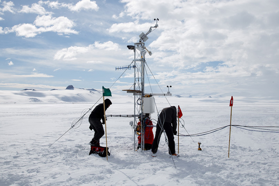
Knowing how much snow falls is a critical question of global importance as knowing how has fallen will help to predict how much sea levels are likely to rise as the climate warms.
“We have a decent idea of how much is melting off of glaciers and ice sheets and stuff like that, but we don’t have a good understanding of how much is actually being added on,” said Scott Landolt, of the NSF-funded National Center for Atmospheric Research.
But, noted Mark Seefeldt, a researcher at the University of Colorado, Boulder and principal investigator on the project, “Precipitation is very difficult to measure in Antarctica for two main reasons. One is that there’s not a lot of precipitation that falls. And the second reason is that it’s difficult to distinguish the falling precipitation from the blowing snow.”
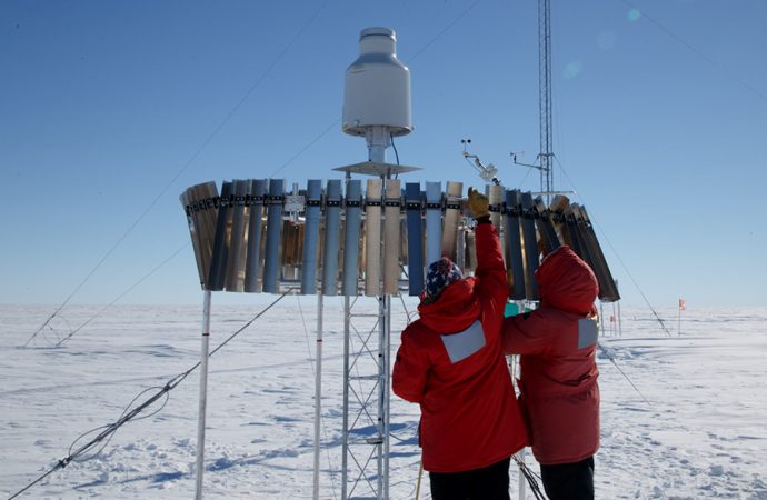
The researchers are hoping that their new Automated Precipitation Systems, known as APSs, can tell which flakes are falling from the sky and which are just getting kicked up by the wind after already hitting the ground. If it works, versions of their weather observatories could potentially be installed across the continent.
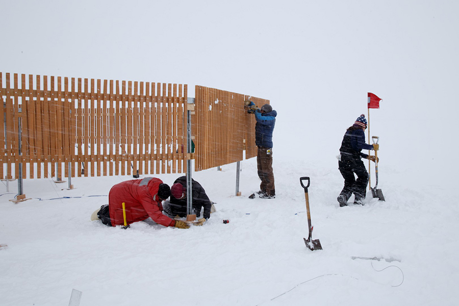
The research is funded by the National Science Foundation, which manages the U.S. Antarctic Program.
“One of the big things in Antarctica right now, is we really don’t know how much snow is actually falling,” said Landolt. “We have numerical weather models and stuff that make estimates, but nobody’s really done a compressive study to see how well those models are actually doing in comparison to actual data.”
The snow in Antarctica is so dry and powdery that often the wind blows it many miles away from where it fell before it sticks to the ground. For researchers trying to figure out the net amount of precipitation in a particular area, this means that any standard precipitation gauge will capture a mix of fallen snow and blown snow, diluting their data.
Seefeldt and his team are hoping that their suite of instruments can filter out which snow fell in the region, and which had been blown from far away.
“One of the theories that we have is that the falling snow should be slightly bigger in size because it hasn’t hit the ground,” Landolt said. “Snow that’s being picked up and blown around has already hit the ground [and] it’s probably a lot smaller in size because the branches on the crystal have gotten broken off and it’s not going to be nearly as big as the falling snow itself.”
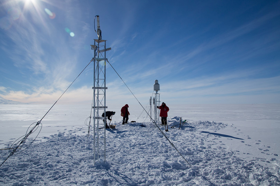
It’s a complicated measurement to make, and the team developed a multi-part method to separate falling from blowing snow while it’s still in the air.
“We’re using a collection of instruments to take a different angle or look at what’s happening at the same time and, from that, to be able to try and distinguish and to be able to measure the actual precipitation,” Seefeldt said.
They’ve equipped each APS with a particle counter that bounce infrared lasers off snowflakes in the surrounding air, measuring their size. At the center of the observatory is an Ott-Pluvio² precipitation gauge, essentially a bucket that collects and weighs whatever snow falls in it.
The precipitation gauge is suspended 11 feet from the ground and behind a wind shield to minimize the amount of blowing snow that enters it. The observatories are collecting large amounts of data from multiple instruments. The team hopes that by looking at everything they’ve collected, they might be able to find new patterns or other indicators in the data to more accurately distinguish blowing from falling snow.
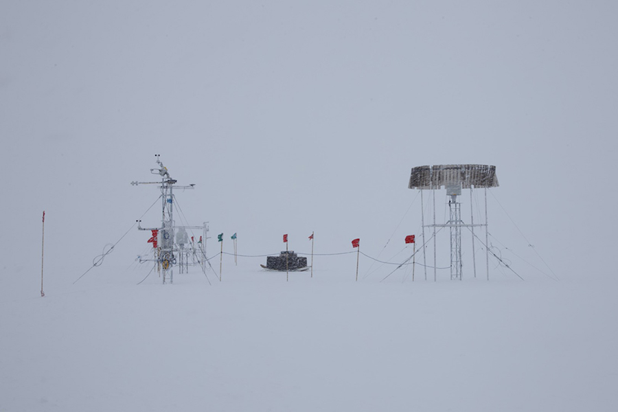
Each APS has a number of other standard weather measuring instruments, including thermometer, an anemometer to measure wind speed, a sonic ranging sensor and a GPS measuring device both designed to measure accumulating snow height, as well as a web cam. They’re also located near a University of Wisconsin-Madison operated Antarctic Automated Weather Station (AWS) so if one instrument fails, they would be able to use some of the data from the University of Wisconsin-Madison to fill in any gaps.
For this preliminary deployment, the team set up stations at Williams Airfield and Phoenix Airfield near McMurdo Station, one at the “Lorne” AWS site 50 miles Southeast of McMurdo on the Ross Ice Shelf and one at “Tall Tower,” another weather station about 100 miles southeast of McMurdo Station.
“Tall tower is trying to evolve into one of the premier meteorological points for the U.S. Antarctic Program so it made sense when we were picking locations to use Tall Tower as one of them,” Seefeldt said.
The project is set to collect data at the four sites for two years. Afterwards the team will analyze all the data they collected and based on how well the system worked, look into whether a network of similar systems could be deployed across Antarctica.
“The goal is that by end of the project, getting a better understanding of how these measurements can be made in a remote and autonomous manner,” Seefeldt said. “From that we can sort of reassess how can we set up more of these instruments in addition into more significant locations.”
Data is now flowing to their lab in Boulder, and they’re beginning the process of analyzing the information that comes in.
Source: The Antarctic News









Leave a Comment
You must be logged in to post a comment.