While the history books give us an idea of what life was like hundreds, thousands, and even millions of years ago, they certainly don’t know it all. Mysteries continue to be uncovered, offering us further glimpses at worlds long forgotten.
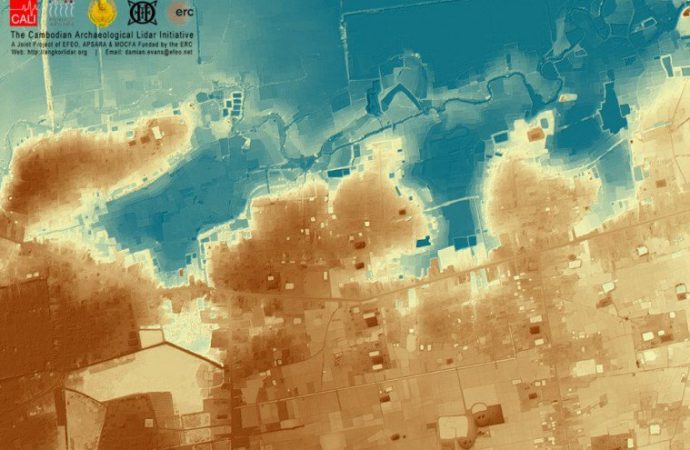
The discovery was made after an initial surveying, which wrapped up in 2012, revealed that the forest surrounding Angkor Wat was hiding a “complex urban landscape.” Researchers announced that they had found a system of roads and cities between 900 and 1,400 years old which was considerably larger than they had initially expected.
This archaeological study, thought to be the most extensive airborne one to date, involved flying over the forest, covering 734 square miles. The team of scientists utilized a technique referred to as LiDAR (light detection and ranging), in which lasers are fired down to the ground and reflected back up. This technique can also see features beneath the forest canopy, with the ability to identify objects easily missed by or hidden to the naked eye.
By finding a vast system of water channels and roads that connected many cities—built centuries before archaeologists originally believed such technology had reached the area—the discovery changes everything we once knew about the Khmer empire, including how it developed, flourished, and collapsed.
It seems that the thriving metropolis fell subject to its immense hydraulic engineering system. The civilization is known for managing the powerful seasonal rains by building canals and reservoirs that provided them with enough food and wealth for such large communities. However, at the Khmer’s peak, scientists believe the changing climate became more unmanageable, shifting erratically between dry and wet periods and causing a series of declines which made it impossible for Khmer to recover.


Leave a Comment
You must be logged in to post a comment.